Type of project: Research project of ZALF Müncheberg
Supervisor: Dr. Roger Funk, Leibniz Centre for Agricultural Landscape Research, Working group: Soil Erosion and Feedbacks
Cooperation partners: Dr. Maik Veste, BTU and CEBra; Dr. Miriam Marzen, University of Trier
About the project
Sandy soils and dry climatic conditions promote the processes of wind erosion and the associated dust emissions, particularly in Brandenburg. The problem has intensified considerably in the last 20 years, as climate change has become noticeable through increasingly prolonged dry periods and rising temperatures.

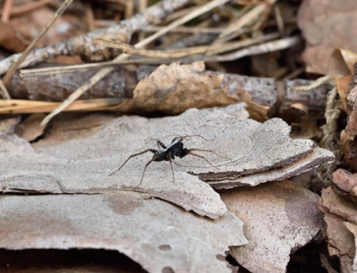
A barchane dune in the forest close to the agricultural fields covering an older surface with a buried humus horizon.

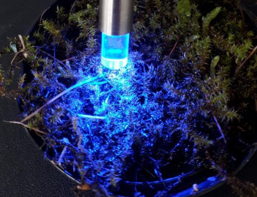
Pürckhauer-soil corer make it easy to get a deeper look into the ground and into its development history. (Photos: R. Funk)
From today’s perspective, the occurrence of wind erosion is often attributed to the current agricultural structure, although this problem has been part of the agricultural use of the soils in Brandenburg for centuries.
Even if individual wind erosion events are difficult to quantify, their repeated occurrence leaves its mark in the landscape. In the deposition areas at the edge of fields or forests, in windbreak hedges or ditches, deposits of several decimetres can accumulate over time. It often takes decades for deposits of just a few millimetres per year to become a detectable layer. Field-forest transitions are well-suited detection areas for this. Here there is usually no clean-up of such deposits, so that their traces have been preserved over time.
The aim of our research project is to detect and describe signs of soil relocation caused by wind erosion in the landscape and to relate them in the broader context of geology, climate and land use, but also to include aspects of soil protection and sustainability. The research station of the Zwillenberg-Tietz Foundation in Linde offers excellent conditions for the realization of this project. Its agricultural fields are completely surrounded by forest, so that material inputs from wind erosion from neighboring areas can be excluded.
First search using historical maps and the structures recorded there, such as roads, field division or field-woodland-distribution, can still be recognized by clear differences in the colour of the uppermost soil layer in today’s aerial photographs. They provide us with the first clues for detailed investigations.